
El Niño is emerging even faster than expected in the Pacific Ocean and odds are increasing that it could become historically strong — a rare “Super” El Niño — by fall or winter.
This is according to a just-released update from NOAA’s Climate Prediction Center that says there is a 2 in 3 chance that El Niño’s peak strength will be strong or very strong.
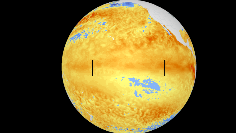
El Niño is a natural climate cycle that happens when the tropical Pacific Ocean warms enough to trigger shifts in wind patterns throughout the atmosphere, which has a ripple effect on weather conditions worldwide.
Droughts and heat waves can flourish in some regions, fueling wildfire danger and water supply concerns, while others are swamped by flooding rainfall. El Niño’s far-reaching effects can also stymie the Atlantic hurricane season. On a larger scale, it causes already rising global temperatures from human-caused climate change to spike even higher. Stronger El Niños make all these impacts more likely.
El Niño occurs about every two to seven years and lasts nine to 12 months. Its strength is measured by how far water temperatures rise above average in a patch of the equatorial Pacific Ocean, and it usually peaks in the Northern Hemisphere’s winter.
Weak El Niño conditions develop once the temperature rises over 0.5 degrees Celsius above average for an extended period of time. Water temperatures must be more than 2 degrees above average for it to be considered a very strong or Super El Niño.
The average water temperature is just below the 0.5-degree threshold right now, but it’s now expected to climb above it by next month, according to Thursday’s monthly update from the Climate Prediction Center. That’s a notable change from last month’s update, which favored neutral conditions — neither El Niño or its cooler counterpart La Niña — through June.
El Niño is then likely to strengthen through the summer and fall. The chances of it lasting through winter have also increased to 96%, a near lock that it does so.
The boost in confidence is due to the vast pool of warm water that’s built up in the depths of the central and eastern equatorial Pacific in recent weeks. This water will eventually rise to the surface, kickstart El Niño and keep strengthening it from there.
But while forecasters are more confident in it forming, “there is still substantial uncertainty in the peak strength of El Niño,” the Climate Prediction Center said.
Still, the odds of a Super El Niño between November and January have increased from a 1 in 4 chance last month to about a 1 in 3 chance in the latest strength probabilities from the CPC.
A stronger El Niño is more likely if changes in the atmosphere continue to sync with changes in the tropical Pacific Ocean this summer, like seeing winds near the equator weaken at the same time ocean temperatures rise, said Michelle L’Heureux, a scientist who leads El Niño and La Niña forecasting at the CPC.
Some typically reliable computer models show this year’s potential Super El Niño could even be the strongest on record. It would be the first Super El Niño since 2015-2016, which was the strongest in National Oceanic and Atmospheric Administration records dating to 1950. Others include 1997-1998, 1982-1983 and 1972-1973.
⛅ Get CNN Weather in your inbox
- The forecast is just the beginning. We’ll send you expert coverage and the stories behind the weather — so you always know more than just the number. Sign up for the newsletter
Even if this El Niño falls short of “super” status, it’s still likely to be a strong one. Stronger El Niños usually pack a bigger punch when it comes to affecting global weather conditions, however impacts don’t always pan out as expected.
The 2015-2016 Super El Niño delivered on its reputation of causing serious drought in the Caribbean, but also failed to produce the wetter than average winter it’s known for in Southern California.
A more likely impact is global heat: El Niño is loading the dice toward 2026 or 2027 becoming Earth’s warmest on record. It’s already “very likely” this year will be one of the five-warmest on record NOAA said on Monday, and that’s not yet accounting for El Niño’s warming wild card factor.
Strong or super, these are the weather conditions El Niño could impact into early next year.
• Hurricane season flip-flop: Stronger El Niños often produce storm-killing conditions in the Caribbean and tropical Atlantic, resulting in fewer tropical storms and hurricanes there. It’s the opposite story in the central and eastern Pacific Ocean where hurricane season is usually busier. That could mean more tropical threats to Hawaii and the Southwest US, depending on where storms track.
• Biggest US impacts are in winter: A warmer-than-average winter is typical from the northern US to western Canada and Alaska, although harsh cold can still pay a visit at times. The southern tier of the US is often wetter and cooler since a beefed up jet stream steers more storms over this region.
• Wet, dry and temperature extremes: In summer, monsoon rain is reduced in India and southeast Asia. The Caribbean also often sees growing drought. Warm and dry winters are typical in parts of southern and eastern Asia. Drought conditions could grow in Southeast Africa during the Southern Hemisphere summer from December to February.


